Featured day
The folk and picnic day
Featured on this site
- Length10 hours
- At the dam70 minutes
- ExtrasCheese, chocolate, picnic
Explore the stops
Short answer
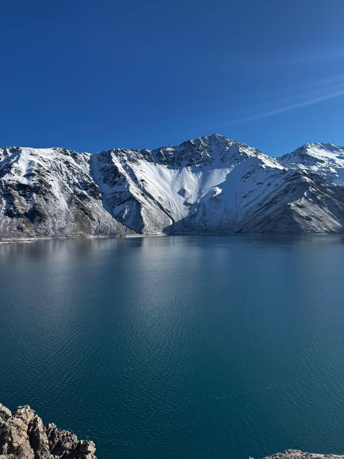
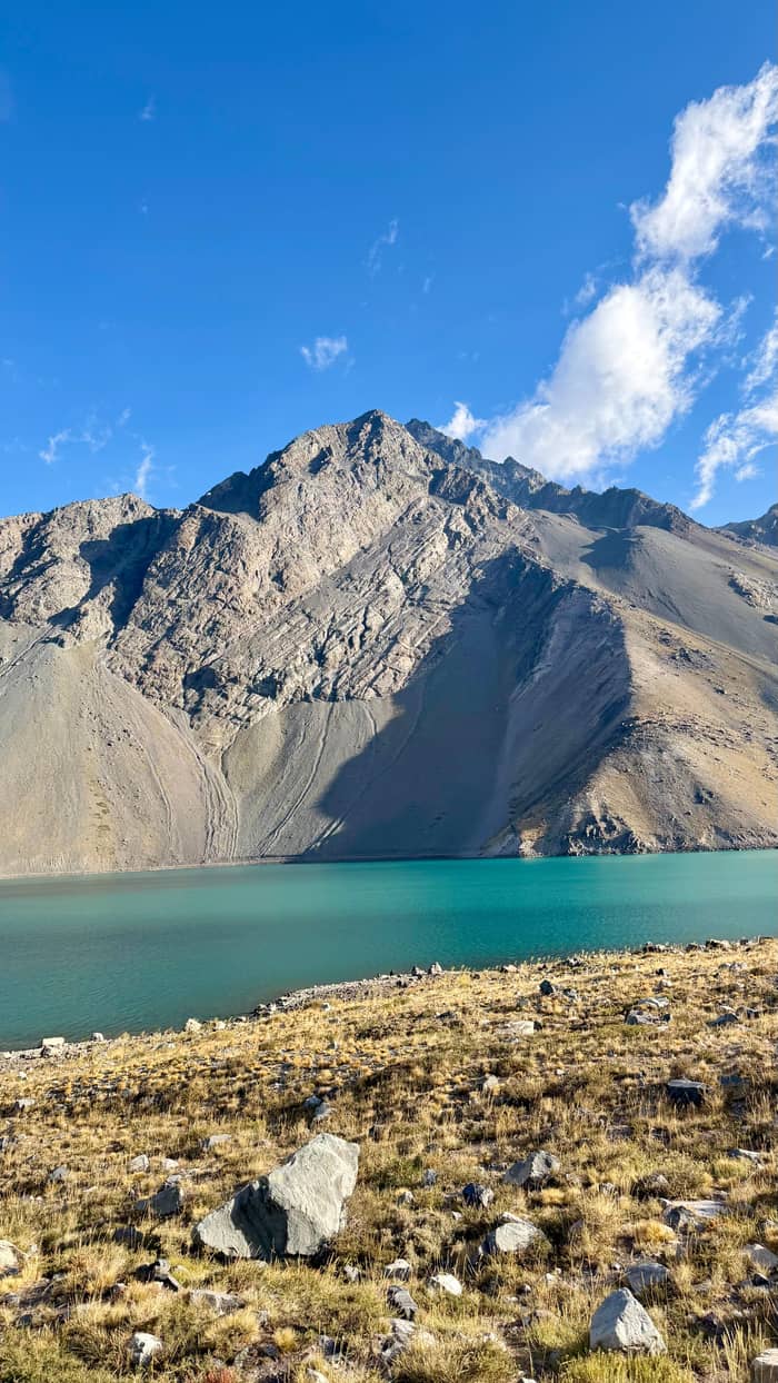
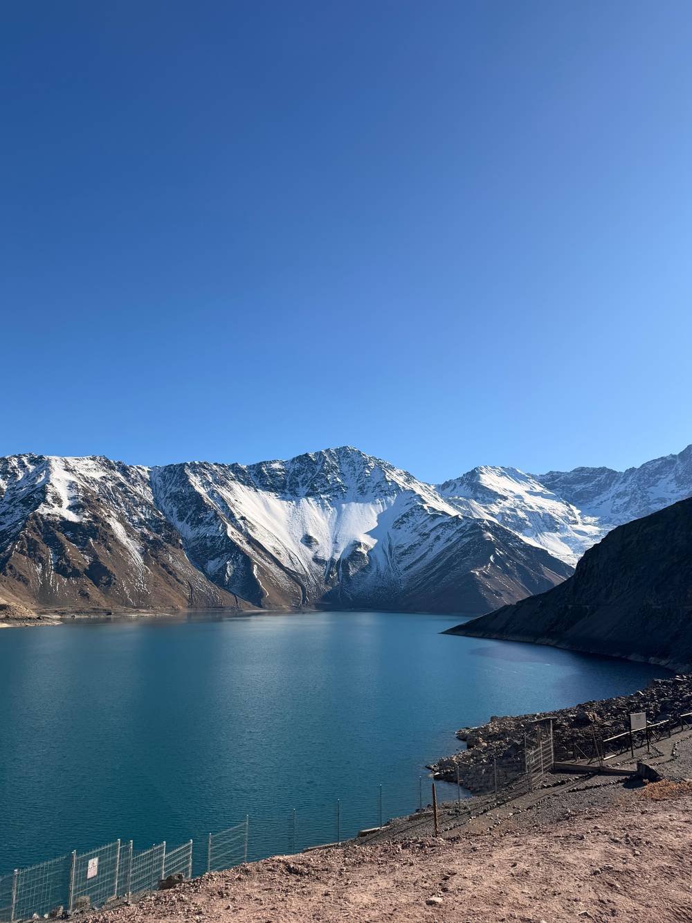
Embalse El Yeso is a dammed lake of turquoise water at 2,500 meters in the Andes above Santiago, the capital's main water reserve, seen from the road or the dam wall trail.
Reservoir essentials
Discover 29 stops
Select a route, then press a pin or stop to read its note and open Google Maps.
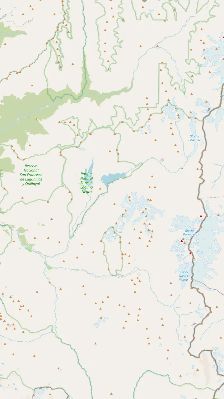
Santiago's main water reserve, a turquoise lake at 2,500 metres.
Google MapsRanger post of the Parque Cordillera area at the reservoir; check the park's opening days first.
Google MapsIts trail opens only with a certified guide or an operator that works with Parque Cordillera.
Google MapsA glacier near the reservoir that has lost much of its mass since the 1990s.
Google MapsThree rustic pools fed by the San José volcano, best from November to April.
Google MapsAn emerald lagoon in a wetland, about an hour's walk away.
Google MapsA village born of cattle farming, quarries and mines, high up the main road.
Google Maps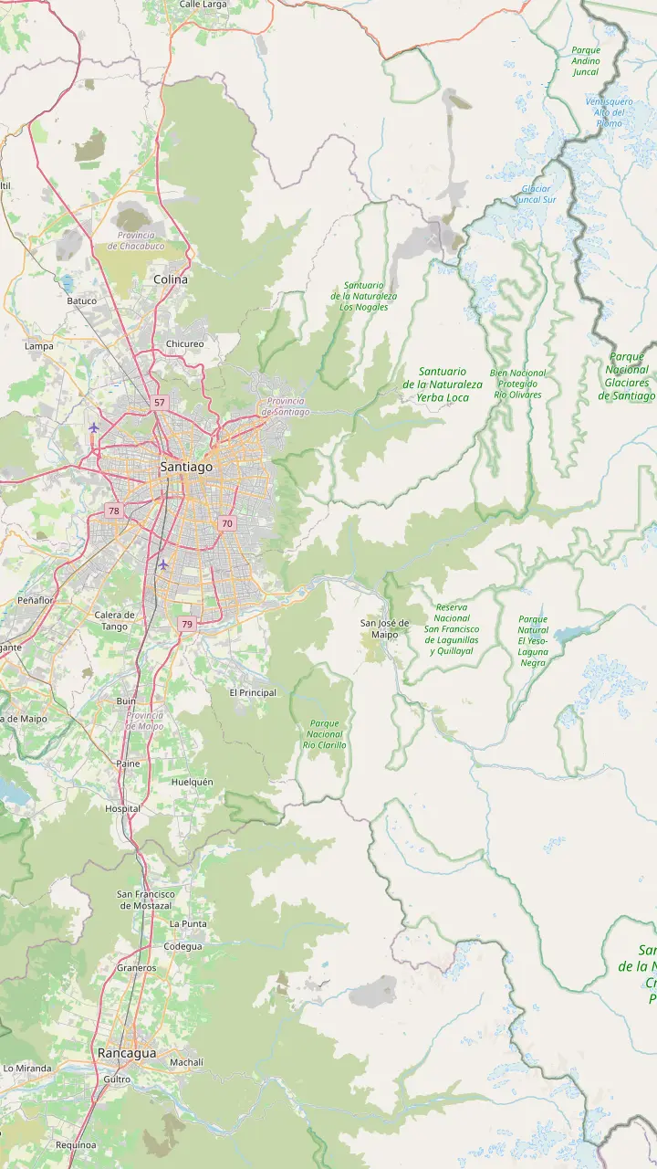
Arrivals land here; the start of the Camino al Volcán is roughly 35 km away by road.
Google MapsThe Metrobus 72 toward Baños Morales leaves this intermodal station in high season.
Google MapsPuente Alto is the town you cross before the road starts to climb into the canyon.
Google MapsThe gateway village from Puente Alto, known for its stonemasons.
Google MapsThe capital of the commune: Plaza de Armas, heritage church and weekend craft stalls.
Google MapsRestaurants with dishes such as cazuela and smoked wild boar, plus local wines.
Google MapsA village born of cattle farming, quarries and mines, high up the main road.
Google MapsRanger post of the Parque Cordillera area at the reservoir; check the park's opening days first.
Google Maps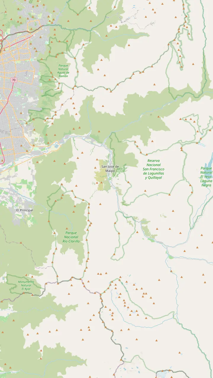
The gateway village from Puente Alto, known for its stonemasons.
Google MapsA small village 30 km from central Santiago, full of summer houses.
Google MapsWhite and red stonework, restaurants and shops line this stretch of the road.
Google MapsLocal craft beer and a sport-climbing crag on Cerro Las Torrecillas.
Google MapsThe capital of the commune: Plaza de Armas, heritage church and weekend craft stalls.
Google MapsA riverside village where rafting and kayak trips set off down the Maipo.
Google MapsRestaurants with dishes such as cazuela and smoked wild boar, plus local wines.
Google MapsThe chocolate house where the site's day tour stops for photos.
Google MapsA nature sanctuary with a short walk to its waterfalls.
Google MapsThe old railway tunnel, a Historic Monument, recommended by the municipality.
Google MapsKnown for the sweets and pastries made in the village.
Google MapsA village born of cattle farming, quarries and mines, high up the main road.
Google Maps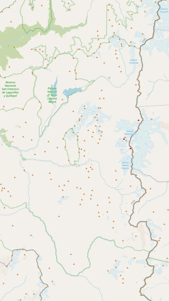
A former mining village where mining tourism is offered.
Google MapsThe village at the entrance of El Morado, with thermal pools and places to eat.
Google MapsThe Valle de la Arena turnoff here starts the trek toward the San Francisco Glacier.
Google MapsBuy entry in advance online; the trail is open only as far as Panimávida.
Google MapsThe glacial lagoon is as far as walkers may go; the glacier itself is off limits.
Google MapsThe peak above the monument reaches 5,060 metres.
Google MapsTerraced natural pools heated by the San José volcano, paid in cash.
Google MapsThe volcano whose heat warms the springs of Colina and El Plomo.
Google MapsMapping data © OpenStreetMap contributors
Embalse El Yeso is the reason most people ride up the Cajon del Maipo: a dammed lake of startling color high in the Andes. Here is what it is, what you may and may not do there, and how to see it well.
Editorial team, cajondelmaipotour.quest · Updated November 11, 2026 · 8 min of reading
Facts at a glance
Embalse El Yeso is, before anything else, infrastructure. Chile's tourism board describes it as Santiago's main water reserve, an artificial lake whose turquoise color stands out against bare rock and snow.1 The Ministry of Public Works water directorate lists its main use as drinking water and its capacity as 220 million cubic meters, which puts the scale of the place in perspective the moment you see the far shore.3
Chile Travel describes the lake as fed by the Yeso and Maipo rivers; the dam itself holds back the Yeso, a tributary in the Maipo basin, in a high side valley of the canyon.5,3 Bare slopes rise straight from the water on both sides, and the valley floor beyond the dam stays wild. When you stand on the wall you are looking at the water that ends up in the taps of the capital, which explains why the rules around the shore are so strict.
The reservoir belongs to a much older story of water in the canyon. The municipality of San Jose de Maipo recalls that an aqueduct was built from Laguna Negra, the lake just above El Yeso, to Santiago, and that it became key to supplying the capital.6 Chile Travel goes further and calls the whole Cajon del Maipo the largest water reserve of the Metropolitan Region.7 Seen that way, the turquoise lake is the most visible part of a much larger water system.
The essentials
| Topic | What the sources say | Source |
|---|---|---|
| Purpose | Santiago's main water reserve1 | Chile Travel |
| Capacity | 220 million cubic meters3 | Water directorate |
| Altitude | 2,500 meters2 | Chile Travel |
| Shore | Restricted to the public18 | Chile Travel |
| Park trails | Dam wall trail only, when we read it4 | Parque Cordillera |
| Park slots | 8:00 to 12:30 and 14:00 to 17:3019 | Parque Cordillera |
Park hours and status change with the season and the weather; check the park's ticket page before you go.
The color is the first thing visitors talk about, and the tourism board calls those turquoise waters one of the most photographed landscapes in central Chile.11 The ranges around the reservoir stay snow-capped for much of the year, so on a clear day you get bands of color: white peaks, brown and ochre slopes, and the strange pale blue of the lake.12 Late in the day the shadows of the ridges creep across the water and the contrast grows even stronger.
Glaciers are part of the picture too. The Echaurren Norte glacier lies near the reservoir, and Chile Travel reports that it has lost a large amount of mass since the 1990s.13 Ice and snow melt feed the rivers that fill the lake, which helps explain why its level and shade change from one season to the next. A photo taken in late spring will rarely match one taken at the end of a dry summer.
For the strongest color, aim for sun on the water rather than a particular hour. Cloud flattens the turquoise into grey, while bright sun brings it back within minutes, so a little patience at the viewpoint pays off. Wind is common in the mountains, and the tourism board warns of strong winds in its advice for the canyon.14 A ruffled surface scatters the reflections, so the calmest moment is usually the best one for photos.
The lake lies at 2,500 meters above sea level, far above the villages you drive through on the way up.2 San Jose de Maipo, the main town of the canyon, sits at 969 meters in the municipality's own table of localities.16 The climb between the two happens mostly in the last part of the trip, on a mountain road that leaves the valley floor and works its way up a side valley, with the river dropping further below you at every bend.
That altitude matters for how you feel and what you wear. Sunlight is strong, the air is dry and cool even in summer, and the tourism board reminds visitors to bring warm clothing and sun protection for the visit.22 Visits are short, but anyone who feels unwell at that height should rest, drink water and stay near the vehicle rather than walk further up the valley. Sip water often, eat something light and move slowly on the dam wall.
The road is part of the experience. Chile Travel describes the final stretch as mountainous and gravel and considers a 4x4 vehicle essential if you drive yourself.10 It also asks visitors to confirm opening times and any snow closure before setting out.23 For a first visit, the same page recommends coordinating the trip with a specialized tour, which takes the gravel driving and the timing off your hands.24
Plan your visit
Pick the line closest to your trip.
If I want the lake and some culture
The folk and picnic day
It pairs 70 minutes at the dam with cheese, chocolate and a picnic.
If I care most about time at the water
A tour with a longer stop
One picnic day allows 80 minutes at El Yeso Dam.
If I want to walk to Laguna Negra
A certified guide
That trail is open only with a guide or approved operator.20
If I want to drive myself
A 4x4 and an early start
The last stretch is gravel and a 4x4 is essential.10
If I travel in winter
Check the road first
The high road may close in winter because of snow.21
Ways to see it
Featured day
Featured on this site
Lake first
More time at the water
Summer only
Two highlights in one
Expectations need adjusting here. Chile Travel states that the public may not go down to the shore, for safety, so the lake is admired from the main road.18 Official pages are not consistent here: the same tourism board mentions kayaking routes on its reservoir page and seasonal fishing in a canyon itinerary.58,59 With the shore closed to the public, plan on looking, walking where it is allowed and photographing, and ask an operator before you count on anything on the water.
A new park is opening up a little more. The ticket page of the Parque Embalse El Yeso, run by the association of municipalities behind Parque Cordillera, said, when we last read it, that the park had begun a trial opening.60 At that point only the dam wall trail was open to visitors.4 The Laguna Negra trail is reserved for visits with a certified guide or with tour operators that have a direct agreement with Parque Cordillera.20
Visits run in two blocks, 8:00 to 12:30 in the morning and 14:00 to 17:30 after lunch.19 When we read its ticket page in November 2026, it showed the park as closed for the winter season, so check the current status before you go.55 The slots exist to spread visitors out, so expect to stick to the time on your ticket. If the park is shut, the viewpoints along the road still give you the classic picture of the El Yeso reservoir with its ring of peaks.
Price your group
Add your group to see each day's starting total.
Compare 3 side by side
Add your group to see each day's starting total.
≈
View≈
View≈
ViewCurrency conversion uses the ECB reference rate on GetYourGuide from-prices. The exact price is displayed when you book.
A morning at the lake
Leaving Santiago
The route climbs from Puente Alto into the canyon.8
Mid-morning
San Jose de Maipo is a classic breakfast stop.9
The climb
The final stretch is mountainous and unpaved.10
At the wall
About 70 minutes on the featured day.
Heading down
Cheese, chocolate and the picnic follow below.
The landscape around the reservoir is far from empty. Chile Travel says you may spot condors, guanacos and culpeo foxes around El Yeso.61 Guanacos tend to stand out against the bare slopes once you know to look for their pale coats. In its birdwatching guide it names the areas of Embalse del Yeso among the great places to see condors in the Cajon del Maipo.57 Pack binoculars and sweep the ridgelines, where the big birds ride the warm air in the middle of the day.
The wider canyon shelters shyer animals too. The tourism board describes its terrain as the habitat of the Andean cat and the puma, both of which you are very unlikely to meet on a day visit.62 Their presence is a reminder that this is a protected mountain environment, not a city park, and that the best thing a visitor can do is stay on the road and the marked trail and take everything back down.
Horses are part of the scene as well. Chile Travel names Embalse El Yeso as the most popular area for horseback riding in the canyon, and local outfitters lead rides around the valley.63 If that appeals, book it separately with a registered operator; the tourism board recommends Sernatur-registered operators for horseback riding and rafting.64 A ride is a slower, quieter way to take in the valley than the van window.
Video
World Travels by Janice & Sean on YouTube · Video data is requested only when you tap play.
El Yeso Reservoir is Santiago's main water reserve and dazzles with its turquoise waters in the heart of the Andes Mountains.
Before you go
Most visitors to Embalse El Yeso in Chile come on a day trip from Santiago, because the long climb and the gravel are easier with someone else at the wheel. Our featured day runs for 10 hours with pickup, and its itinerary gives 70 minutes at El Yeso Dam with a photo stop, a guided explanation and views along the way. It costs from $42 and adds goat cheese, Casa Chocolate and a picnic further down the canyon.
Other days spend a little longer at the lake. One picnic tour allows 80 minutes at El Yeso Dam with a walk, from $36. Another, from $35, notes that between April and August reaching the viewpoint involves a walk of approximately 20 minutes. Compare the time at the reservoir, the guide languages and the extras rather than the price alone, because a few dollars rarely matter as much as an extra half hour beside the water.
If you want the hot springs as well, some tours combine the lake with Termas Valle de Colina in a single long day. Those days are shorter at the reservoir and depend on summer weather, so they suit travelers who see the lake as one stop among several. If the lake is your main reason to go, choose the tour that gives you the most time on the wall, and keep the hot springs for a second trip into the canyon.
Time at the reservoir passes quickly. Walk a little away from the busiest viewpoint, frame the dam wall or a ridge in the foreground, and wait for a gap in the clouds before you shoot the water. Wide lenses capture the scale of the valley, but a short telephoto helps you pick out the pattern of the slopes reflected on the lake. Keep a lens cloth handy, since dust from the gravel road settles on everything.
Dress for a sudden change. Even on a warm day in Santiago the wind at the reservoir can bite, and the listing of the featured tour warns that mountain weather changes quickly between cold, heat and strong wind. A light down jacket, sunglasses, a hat and sunscreen cover almost every case. Good shoes matter if your tour includes the walk to the viewpoint or the dam wall trail, where the ground is loose and uneven in places.
Leave nothing behind, not even fruit peel or a tissue: the lake below is drinking water for the capital. The tourism board asks visitors to carry water, snacks and a trash bag, and notes that some areas require cash for entry fees.56 Do not count on buying food at the dam: bring what you need from Santiago or from the canyon stop where the featured tour breaks for coffee and breakfast on the way up.
FAQ
It is an artificial lake in the Andes that serves as Santiago's main water reserve.1
Chile Travel places the turquoise lake at 2,500 meters above sea level.2
The national water directorate lists that capacity and drinking water as its main use.3
Chile Travel names condors, guanacos and culpeo foxes around the reservoir.61
The featured day gives 70 minutes and another picnic tour 80 minutes.
Sources
Up next
Planning a day in the Andes from Santiago? Ask a real person.